
Surveying & Geospatial Services
At Kousain Engineering, we bring decades of surveying excellence to every project we undertake. Our surveying division combines deep local experience in Kashmir with cutting-edge European engineering standards, ensuring unmatched accuracy and reliability.
Our team of licensed surveyors and geospatial technicians understands that precision is the foundation of all great engineering. Whether it’s defining property lines, preparing base maps, or providing construction layout, we employ the latest technology to deliver results that exceed expectations.
Our Core Surveying Capabilities
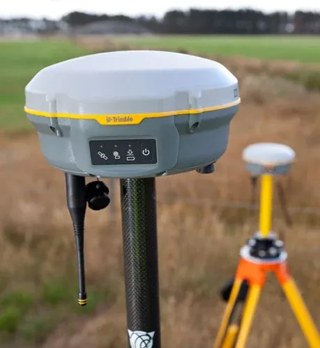
1) GNSS & DGPS Surveying
We specialize in Global Navigation Satellite System (GNSS) and Differential GPS (DGPS) surveys, utilizing the latest multi-frequency receivers to achieve survey-grade accuracy below 10 centimeters.
Our teams are equipped to handle everything from large-scale topographic mapping to control point establishment, ensuring faster, more accurate, and more efficient surveying outcomes.
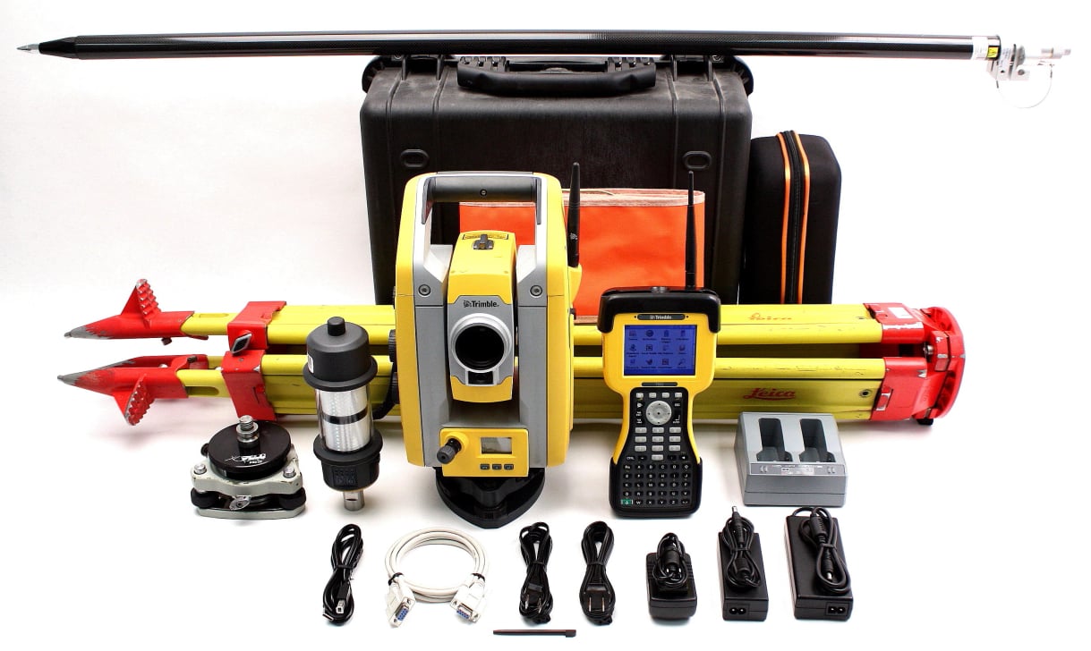
2) Robotic Total Station & Conventional Surveying
Kousain employs state-of-the-art Robotic Total Stations and electronic distance measurement (EDM) instruments for high-precision line, level, and angle measurements.
These advanced systems allow single-operator efficiency, improved data accuracy, and seamless integration with digital terrain models.
3) GIS & Spatial Data Services
Our GIS experts work hand-in-hand with clients to capture, analyze, and visualize spatial data.
From creating high-resolution digital terrain models (DTMs) and digital elevation models (DEMs) to managing complex geodatabases, we ensure spatial intelligence that supports planning, infrastructure, and decision-making.
4) Boundary & Cadastral Surveys
We are licensed to perform boundary surveys that precisely determine property lines, corners, and extents of easements or encroachments.
These surveys form the legal foundation for land transactions and development, ensuring that our clients’ rights and boundaries are clearly defined.
5) Topographic Surveys
Our topographic surveys accurately map natural and manmade features such as trees, roads, utilities, and contours.
These detailed maps serve as a base for civil design and construction, enabling engineers and architects to work with accurate ground models.
6) Construction Staking & Layout
Construction staking forms the bridge between design and reality.
Our field teams establish reference points and markers with precision to ensure every element; from foundations to road alignments; is built exactly as designed.
At Kousain, we understand that every millimeter counts.
7) Subdivision & Land Development Surveys
From residential plots to large-scale developments, we provide full surveying services for property subdivision and layout.
Our experience spans commercial, institutional, and industrial projects throughout Kashmir, making Kousain a trusted name in land development surveying.
Ready to move forward with your project? Request assistance by filling out the form below, and we'll connect you with our top surveying services.

No Code Website Builder